
Dock yourself at the seamen’s club in Ballard Estate to explore the city’s maritime depiction in print imagery
Royal Bombay Yacht Club, 1920
It’s difficult to imagine if Mumbai would still be the hustling, bustling Maximum City that we know and love today, had it not been for the sea. From the Portuguese and the British to contemporary geopolitical forces, the metropolis’ maritime connection has been sliced and diced over the years. In an exploratory walkthrough this week, Mrinal Kapadia, founder, India Visual Art Archive, will take participants through printed imagery depicting maritime Mumbai.
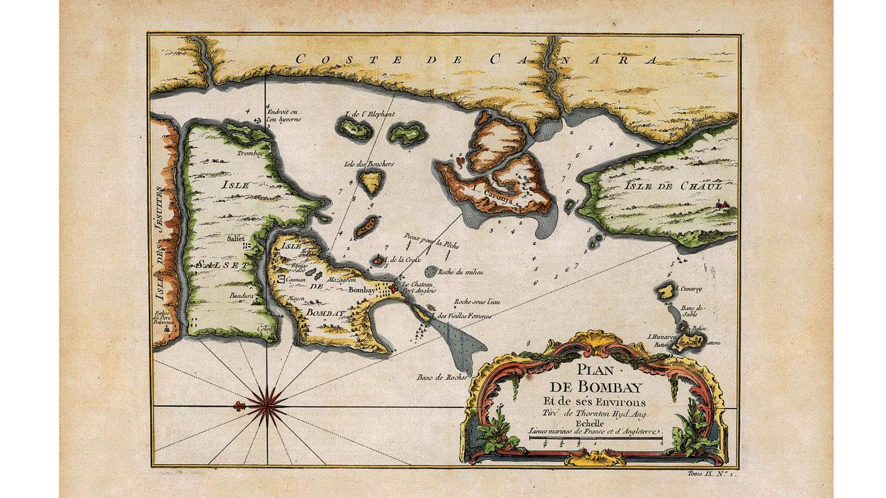
Plan de Bombay et de Ses Environs – Jacques Nicholas Bellin, 1752 (based on the earliest East India Company navigational map of Bombay from 1703)
Kapadia’s session, presented by the Maritime Mumbai Museum Society along with the India Visual Art Archive, The Museum Society of Mumbai and the Chhatrapati Shivaji Maharaj Vastu Sangrahalaya, will take place at the Royal Bombay Seamen’s Society in Ballard Estate. The city chronicler hopes to trace the chronological order in which Mumbai has evolved from Heptanesia to Bombaim and finally, into Bombay. “We’ll look at the humble beginnings of the city. In the course of it, we’ll see how the visual imagery gets bolder as the British grow powerful and other colonial powers start withering away. Eventually, once the Crown takes over, a lot of the printed imagery becomes a mouthpiece to further colonial expansion,” he adds.
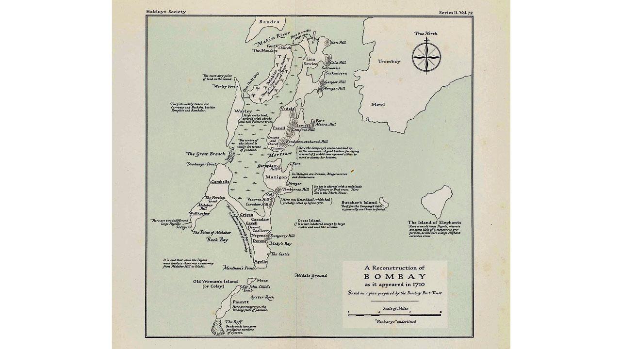
Bombay as it was in 1710. Pics Courtesy/Collection of Mrinal Kapadia, India Visual Art Archive
The journey will begin with the Portuguese imagery of then Bombay, which is limited to just a few maps. As compared to the British, who were obsessed with gathering knowledge about the city’s shoreline, the Portuguese were concerned with sailing safely. “In the [Portuguese maps], the landmass of Bombay is almost completely unrecognisable. They were only concerned with trading and refitting their ships at the Bombay harbour,” Kapadia notes. The East India Company, and later, the British Crown, on the other hand, dove deep into figuring out the soundings and depth of the water, and the outlines of the land. “The British were focused on depicting everything accurately, reflected in the way the maps evolved in the era. We’ll see how the landmass gets clearer and recognisable,” he informs us.
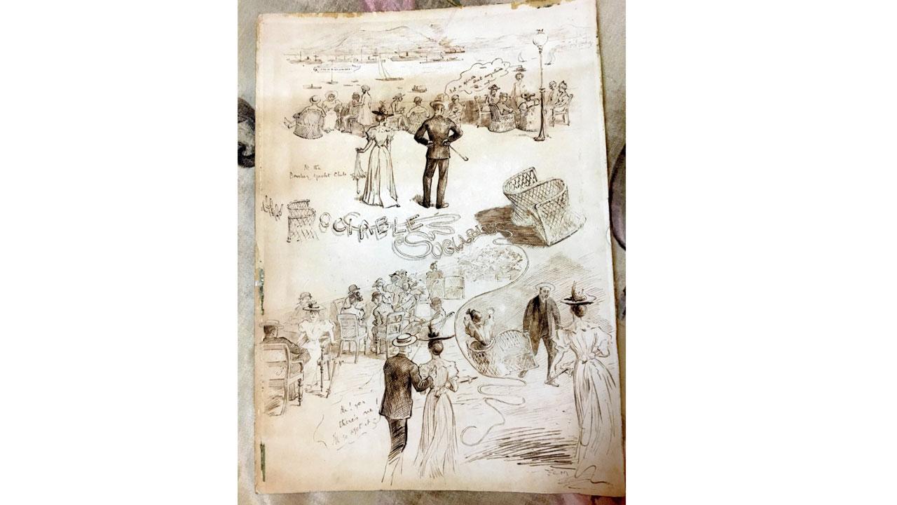 A Typical Day at the RBYC (a caricature depiction), early 20th century (signed by FCM)
During the walkthrough, participants will get a front-seat view of how Mumbai went from being a fledgling outpost in the 17th century to a busy maritime township and harbour by the 19th century. Kapadia will dip into how water started being used for recreational purposes with the setting up of the Royal Bombay Yacht Club. “There were regattas hosted by the yacht club. I have some old photographs of the regattas. There’s a sketch of a typical day at the yacht club then. If we go back to the late 1800s and early 1900s, I will also be talking about the dock development,” he elaborates, promising to keep participants on their toes in this journey. Are you ready to set sail?
On: Today; 5 pm to 7 pm
At: 18, R Kamani Road, Ballard Estate, Fort
Log on to: @maritimemms
Call: 9820465003 (limited seats; pre-book to confirm your spot)

Source: https://news.google.com/__i/rss/rd/articles/CBMiWGh0dHBzOi8vd3d3Lm1pZC1kYXkuY29tL211bWJhaS1ndWlkZS90aGluZ3MtdG8tZG8vYXJ0aWNsZS9hbGwtYWJvYXJkLWZvci1ib21iYXktMjMyNTUxMzXSAQA?oc=5


